Mesa County, Colorado Cemeteries [Work in Progress]
This page was last modified:
Note: The MCGS Cemetery Project is a multi-year undertaking. Highlighted text are items that could be addressed during this project.
In conjunction with the Museum of the West, the Mesa County Genealogical Society is compiling a comprehensive view of Mesa County cemeteries. This project is a "work-in-progress" and some cemeteries are listed on this page. As additional information for each cemetery is added it will be set up on its own page that can be accessed through the table below. A future addition will be a search option.
We would like to thank, in particular, Museum of the West researcher/volunteer Marie Tipping for her ongoing discussions over the last several years about the local cemeteries and burials so that there was a starting point to get this project up and running.
If you are interested in Mesa County Cemeteries joining the Mesa County Genealogy Society and becoming part of the Cemetery Project Committee would be a great way to help the community gather details on our past. At this time (2024) the committee is working with the Whitewater Cemetery Association to thoroughly document this historic cemetery.
You can contact the Cemetery Project Committee by using 'See Email Address' button below
The original 2022 MCGS Cemetery Project Proposal can be found here.
The MCGS Cemetery Project Committee Check List can be found here.
Cemeteries: Alphabetical List
** In conjunction with the 'Colorado Cemetery Names Project' [2004], MCGS member Dennis R. Jenkins collected location data and photos of the Mesa County, Colorado cemeteries. These cemetery photographs have the following citation: 'Photo Credit: DRJ 2004'. The original project notebook can be found in the Mesa County Genealogical Society Library and includes detailed location including GPS details and Topographic map printouts.
The City of Grand Junction manages multiple municipal cemeteries including: The Municipal, Ohr Shalom, St Anthony, Veterans, Odd Fellows, Masonic, Calvary, and Orchard Mesa. A general map of these cemeteries can be found on the the City of Grand Junction 'City Cemeteries' page here. You can search for individual burials here.
History of Mesa County and its cemeteries...
Cemeteries by Gertrude Rader [**Unknown source. If anyone has any information on where this was originally published it would be helpful. Spelling has been corrected from the original.]
With every death there was always a burial ceremony. Some were in the Elmwood Cemetery and some in the Catholic Cemetery a mile north of Fruita. As early as 1881 these plots were designated as Burial Grounds but in 1897 the grounds were plotted and designated as Cemeteries of the lower valley. Many U.S. Service men are buried in these cemeteries, men from the Civil War from both the North and South sides. There are graves of veterans from the Spanish-American War, World War I, World War II the Korean conflict and from battles in Vietnam. Many of these men were killed in combat and later reburied here. There are about 200 serviceman's graves in the Elmwood Cemetery. One section was designated for the bodies of servicemen, identified by their low government headstones. William Pabor, founder of Fruita, is buried in the South Section. He has a rock marker with a plaque. There was a time when many of the markers were made of wood by the family. Some were of rock. When marble was located in the canyon north of Palisade it was often used to mark grave sites, as well as to rip-rap the river banks upstream. For many years the graves were rounded mounds of dirt but in 1926these were leveled, the sunken graves filled in, irrigation water was brought to the site and the area was seeded to grass and flowers and many shrubs were planted. A year or so before the seeding was done a flagpole was erected, seats and benches were built and the cemetery adopted a community project. Two or three times each year before Memorial Day, the community sponsored work projects to clean up the cemetery, with a big 25 cent dinner served to the volunteers. Proceeds from the dinner went to the Cemetery Auxiliary. I don't remember how or why Colorado was given six European Birch trees but the Elmwood Cemetery received the one given to Mesa County. This was very special. About twenty years after the tree was planted and had grown and prospered, the Cemetery Board was notified that the American flag had whipped into the tree in a storm and damaged it so badly that the tree had to be cut down. Not so! The servicemen of the community dug up the entire foundation for the flagpole and so that the tree could be saved. Today the cemetery is a Mesa County project.For years the Highpoint Club in Fruita attempted to find out the favorite hardy flower of shrub of each person buried during the year and the next spring these favorite plants were set out in memory of each of these persons. In February 1932 many towns throughout the country had a contest for community beautification in honor of the 200th birthday of George Washington. The lower valley entered Fruita in the contest and many trees and shrubs were planted in what is now Circular Park in both of the cemeteries and the city park. Circular Park had been square up to that time, with hitching posts around it and a horse watering trough on the east side. There was a great deal of dissatisfaction about the cutting of many large trees in the Square and the removal of the water trough. Evergreens were planted at the Elmwood Cemetery and many shrubs and hardy bulbs and flowers. During one clean-up day two wagons were loaded with with debris from the cemetery. One was filled with old broken bottles, dead limbs, cans, and dead grass; and the other with iris, orange lilies, lemon lilies, day lilies and a few tulip bulbs that had been raked up. The wash between Fruita and Elmwood was the dumping place for this trash. The men dumped the cans and broken bottles and the women covered them with the roots and bulbs that had been discarded as the cemetery rows had been straightened. All this was done about ten days before the judges were to look over the gardens and cemeteries honoring George Washington. Would you believe it? The buds and bulbs had all opened up and the dump was beautiful. The judges placed it first in 'sunken garden beauty'. Women who had planned, spent their time and woked hard to make their sunken garden entries beautiful were disgusted ty the judges' decision and protested. Old timers in the area still laugh about the Elmwood Dump getting the first prize. (It only lasted that one Spring.) There are small cemeteries at Appleton, Loma, Rhone and on the High Line. [**Interesting, do we know were these are?] Many families had their very small children buried on their own property. By the side of the rose bush or just outside the parents bedroom window were the two places most frequently selected by local people for such burials.
Miscellaneous cemetery history notes: From the 'Journal of the Western Slope, Vol 6, No 1, Winter 1991.
"Pg 41: Cemeteries of the Lower Valley: Elmwood Cemetery, Catholic Cemetery 1 mile north of Fruita. 1881, Fruita had a designated burial ground. 1897, Grounds plotted and designated as cemeteries of the Lower Valley. 200 +/- servicemen graves in Elmwood. William Pabor - Fruita Founder buried in South Section of cemetery. Marble was from canyon north of Palisade.. Pg 42: Details of the annual cemetery clean-up.
Small cemeteries at: Appleton, Loma, Rhone and on the Highline. Many families buried their very small children on their own property, usually in an area by the side of a rosebush or just outside the parents bedroom.
Most cemeteries were uncared for plots of ground and each family was responsible for family grave care."
Many researchers have been involved with the research into the history of cemeteries and burials of Mesa County, Colorado. Since the 1970's The Museum of the West, Mesa County Genealogical Society members, local community members, local historians, and various community groups have worked to research and catalog the history and burials in Mesa County. These pages will help pull together all the research over the years into one central location. A separate page within this project could detail the efforts of some of these individuals.
Some of the MCGS Members who have worked in the past on previous cemetery projects include: Alice Devine, Phyllis George, Betty Jane Grosskopf, Wynona Hennessey, Dennis Jenkins, Dorothy Inscho, Pat & Linda Geary, Ron Halsey, Carolyn Howard, Margo Lurvey, Jay Cayton. Verna Seal, Dorothy Roper [more names to be added].
During the original planning of the original cemetery project a list of Mesa County cemeteries was located at the Colorado State Archives in Denver, CO which was completed by the Work Projects Administration (WPA) as part of their Historical Records Survey. This list includes the cemetery name and the Township, Range, and Section details. The list can be found here.
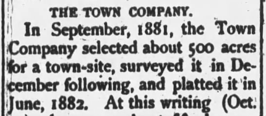
Town Company Notice, GJ News, 04 Nov 1882, Sat, pg 3
Kathy Jordan a Grand Junction historian who, unfortunately, passed away in 2013 completed much Mesa County Cemetery research. Links to some of her columns are listed below. **Note: These links access the web.archive.org and are occasionally slow to load.
- 'Unearthed Headstone Leads Columnist on Trail of History Mystery'
- 'Ross Cemetery'
- 'Early-Day Cemeteries Proved Profitable to Growing Town'
- 'OM Cemetery Centerpiece of Remembrance'
- 'Potter's Field'
First Recorded Death in Mesa County
Garland - Infant of Mr. & Mrs. Garland, died in December 1881 and may have been buried in Potters' Field.
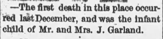
Garland Infant Obituary, GJ News, 04 Nov 1882, Sat, pg 3
Back to Cemetery Alphabetical List
Mesa County Oral History Project related to cemeteries
Thank you to Kaia Michaelis, Executive Director of the Museum of the West, for the following links to the Mesa County Oral History Project.
- This link will take you to all of the oral histories where the word 'cemetery' is included.
- If you are interested in the Mesa County Oral History Project oral histories in general this link can take you there.
Possible Questions to be Answered
5 July 1883 noted in County Commissioner's Record - Burial - William Duncan. A copy of this record might provide more information on the place of burial. Was it perhaps 'Hope Cemetery'?
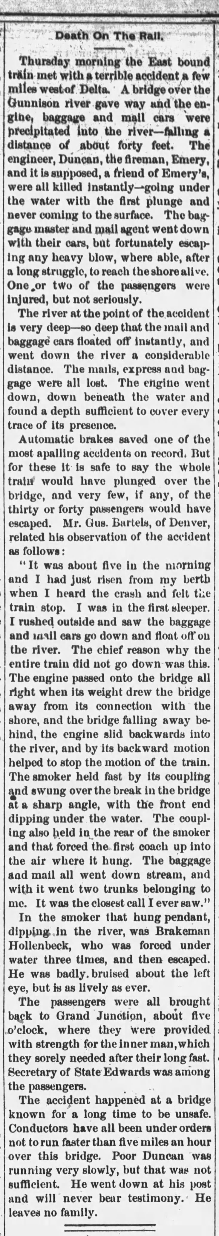
Click image for complete obituary
Death on the Rail, GJ News, 26 May 1883, pg 3
The murder of William Wencel was reported in the Grand Junction News on 25 Nov 1882, however no burial information was included. Where is this gentleman buried?
Colorado Historic Cemetery Association
"Purpose": To promote the preservation, interpretation and sustainability of historic cemeteries..." You can view their website here.
Miscellaneous Mesa County, Colorado Online Cemetery Information
Mesa County Genealogical Society Cemetery Database (pdf file)
Interment.net Limited burial information.
USGenWeb Archives
Find a Grave
Mesa County Colorado Genweb Colorado Gravestones
Billion Graves
Cemeteries: Chronological List
As the initial information on each cemetery is reviewed and additional information is added the cemetery will be removed from this list and a seperate page will be created.
Back to Cemetery Alphabetical List
Ohr Shalom Cemetery (City of Grand Junction)
???? (history?)
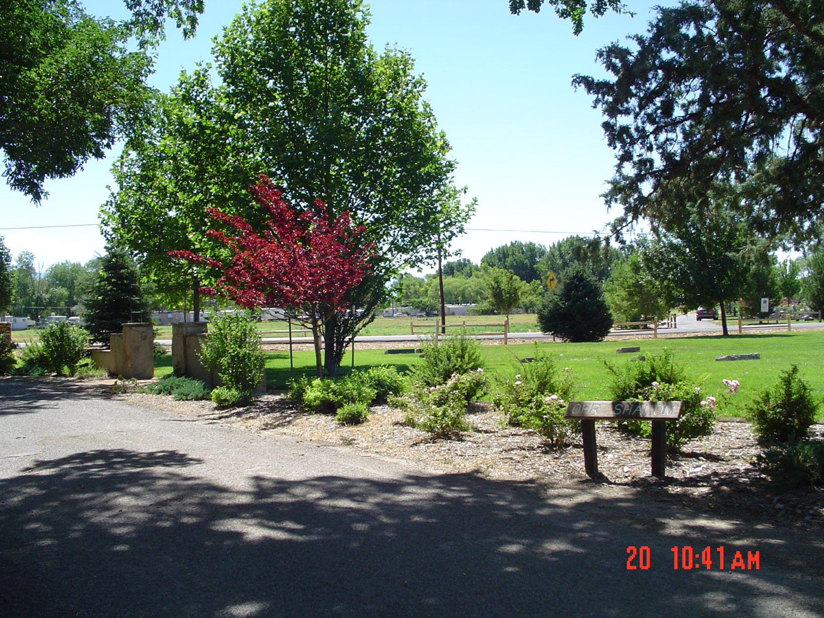 Ohr Shalom Cemetery **Photo Credit: DRJ 2004
Find a Grave - Ohr Shalom Cemetery
21 burials are listed on Find A Grave as of 31 May 2022.
Gate Location Address:SE Corner of Municipal Cemetery; Also on west side of Canon St (26 1/4 Rd)
Back to Cemetery Alphabetical List
Orchard Mesa (Grand Junction)
1887/88 - Present
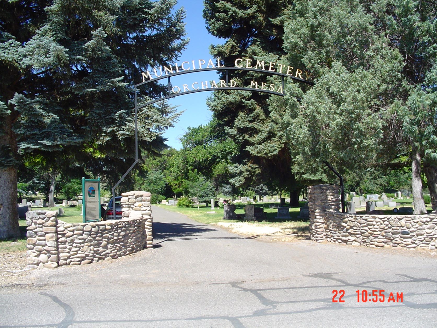 Orchard Mesa Cemetery **Photo Credit: DRJ 2004
Find a Grave - Orchard Mesa Cemetery
Gate Location Address: 263 26 1/4 Rd
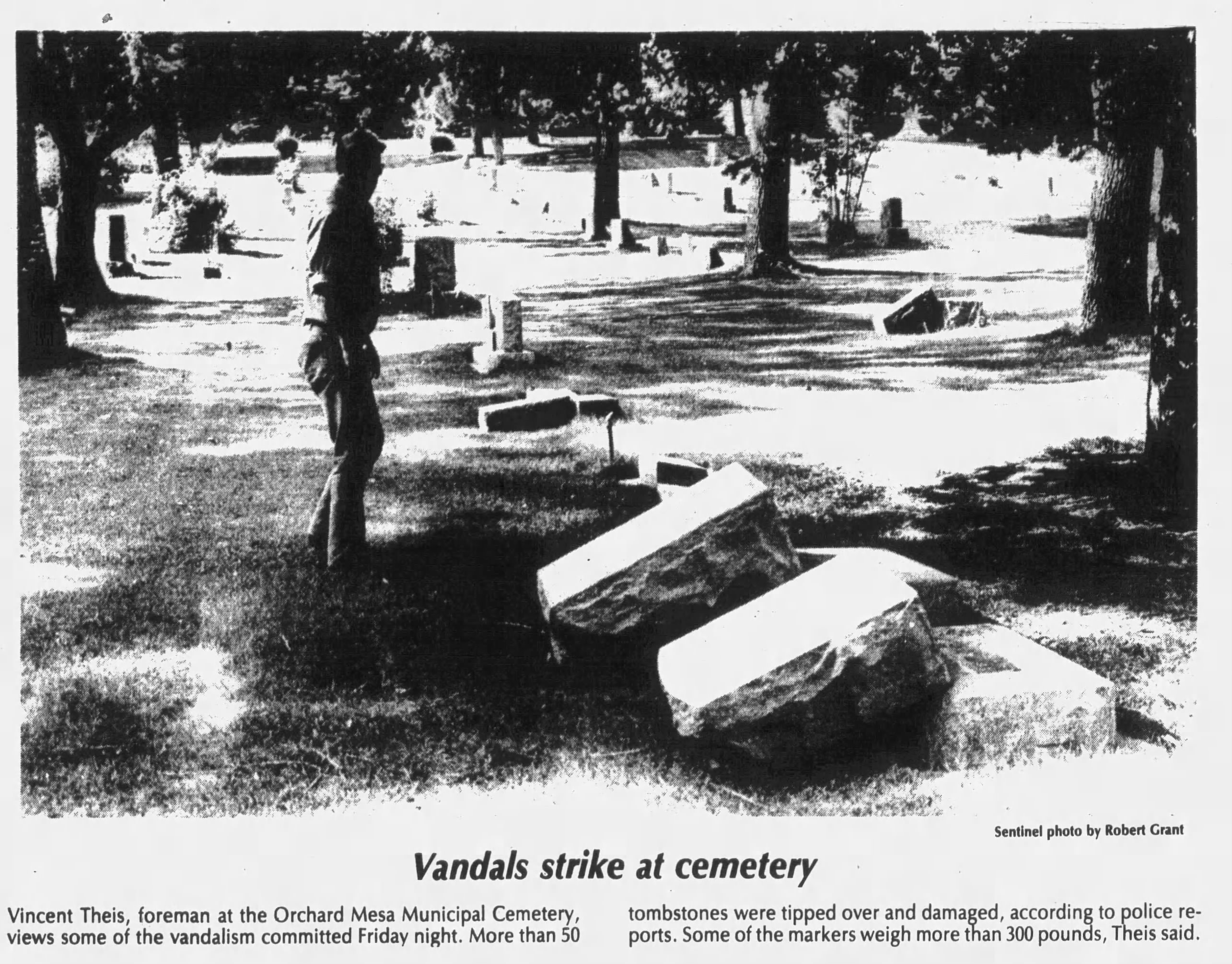 Orchard Mesa Tombstones Vadalized Daily Sentinel 07 Sept 1980, Pg 20
Deeds for the Orchard Mesa Cemetery are being input to a database and will be available on this website in the future. They include the name of the purchaser, date purchased, along with the Lot and Row within the cemetery.
Orchard Mesa Cemetery sustained some damage during heavy flooding in 1895. You can read the article here.
In the 29 July 1988 Daily Sentinel Dave Fishell, a local historian, wrote an article about an infant found buried in a cave new Whitewater. Although the child was never identified, it was was eventually re-buried in the Orchard Mesa Cemetery. You can read the full article here.
The Orchard Mesa Cemetery details will eventually be move to a separate page. However until then some obituary copies will be noted here.
- Phildellia Franklin "Badger" Haynes: 1857 - 1894.
Back to Cemetery Alphabetical List
Sacred Heart Catholic Cemetery (Fruita)
Calvary Cemetery
????
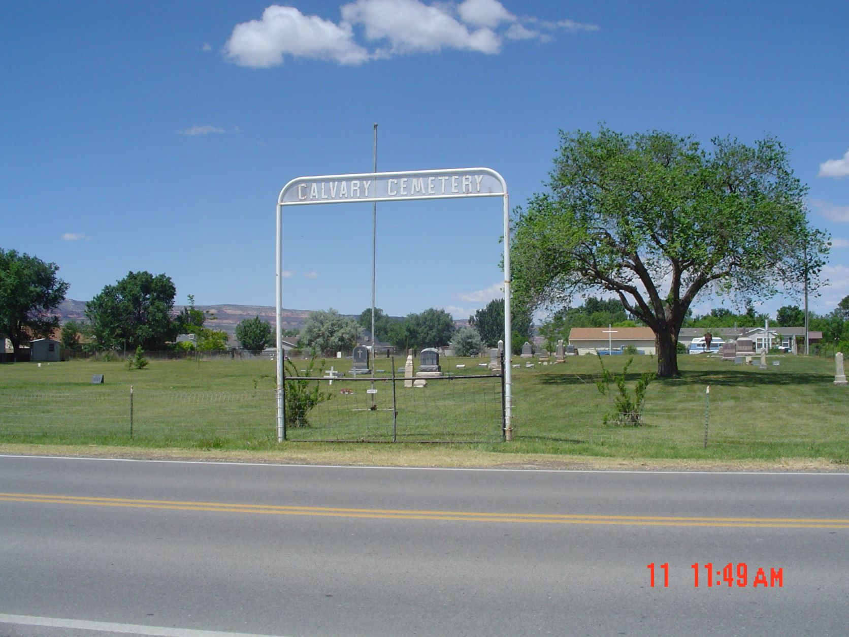 Sacred Heart - Calvary Cemetery **Photo Credit: DRJ 2004
Gate Location Address:17 1/2 Road about 1/2 mile North of K Road, Fruita
Directions;From roundabout in Fruita (Aspen Ave & Mesa St.) go East on Aspen about 1/4 mile to 17 1/2 Rd. Turn Left and go North about 0.9 miles. The Cemetery is on the left (West) side of the road.
Back to Cemetery Alphabetical List
Calvary (City of Grand Junction)
???? (need a history)
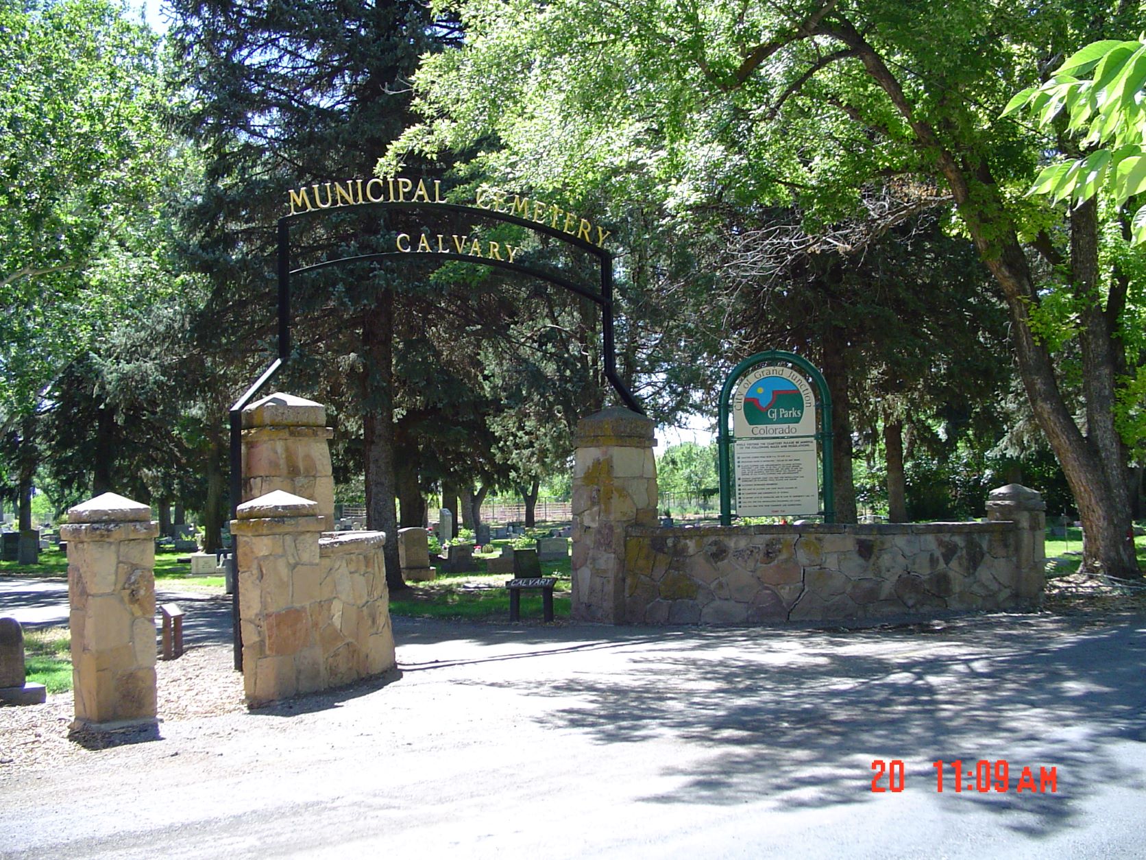
 Calvary **Photo Credit: DRJ 2004
Find a Grave - Calvary Cemetery
Gate Location Address: 280 26 1/4 Rd
Directions:Take Highway 50 South to Canon St (26 1/4 Rd). Turn South and go .04. The Entrance to the cemetery is on the left (East) side of the road.
Back to Cemetery Alphabetical List
Cedar Crest (Collbran)
????-???? (need a history)
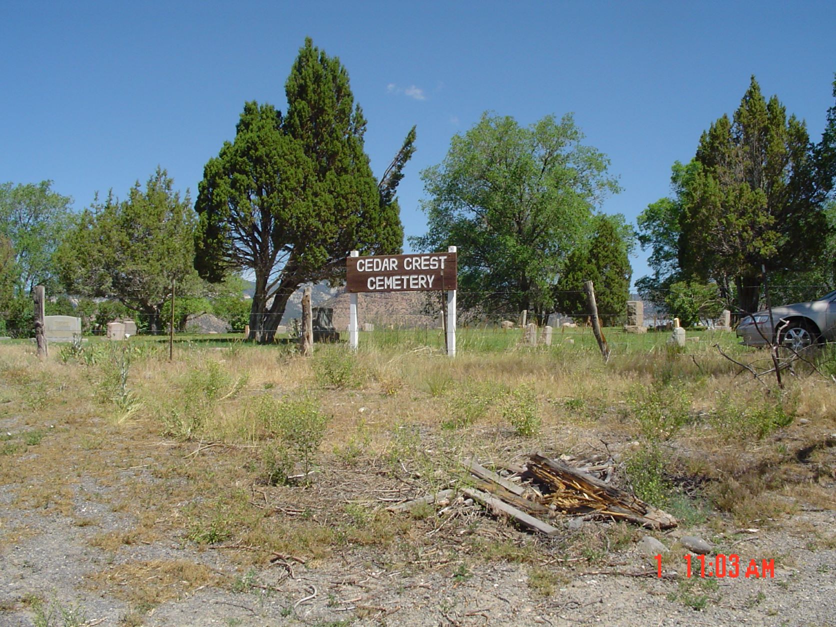
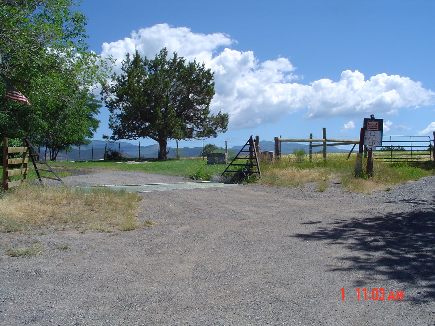
Cedar Crest Cemetery and Access Road - **Photo Credit: DRJ 2004
You can search for burials and tombstone photographs at Find a Grave.
Some burials not listed in Find a Grave are located at Billion Graves.
Gate Location Address: About 15716 - 58.85 Rd, Collbran
Directions: Take Hwy 330 East to 59.5 Rd; go about 0.4 miles South on 59.5 Rd to 58.85 Rd; Turn East and go North up the hill for about 0.15 miles to the cemetery.
Row lists have been provided by former MCGS member Margo Lurvey. Will be reconciled with Find a Grave database. Cemetery plot map would be helpful.
Back to Cemetery Alphabetical List
I.O.O.F. (City of Grand Junction I.O.O.F.)
???? (need history)
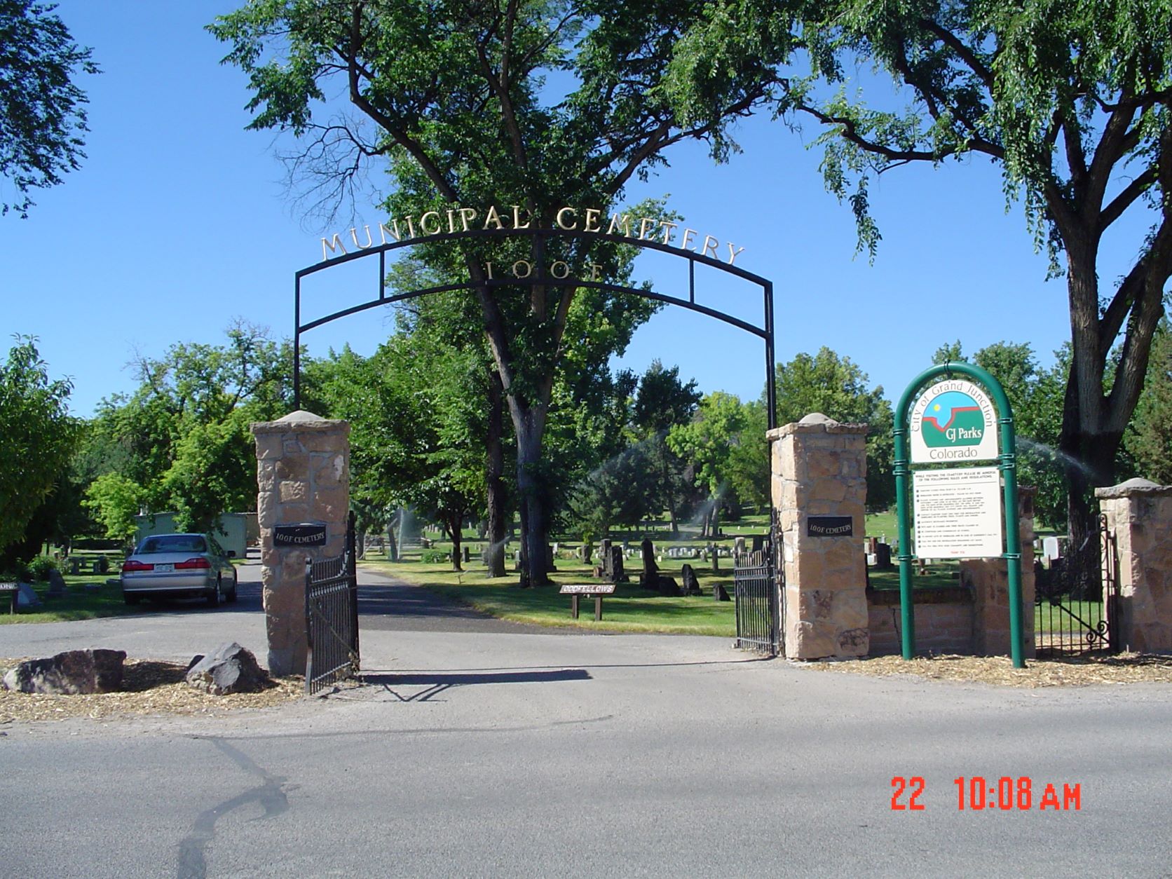
I.O.O.F. Cemetery (Grand Junction) **Photo Credit: DRJ 2004
Find A Grave - I.O.O.F. Cemetery.
Gate Location Address: B 3/4 Rd just West of the Masonic Cemetery
Directions: From Highway 50 South of Grand Junction P.O. turn South on Canon Road (26 1/4 Rd). Go South about 0.4 miles to B 3/4 Rd. Go West past Masonic Cemetery about 0.1 mile. IOOF Cemetery is on the left (South) side of road.
Back to Cemetery Alphabetical List
Masonic (Grand Junction Masonic)
1891...????
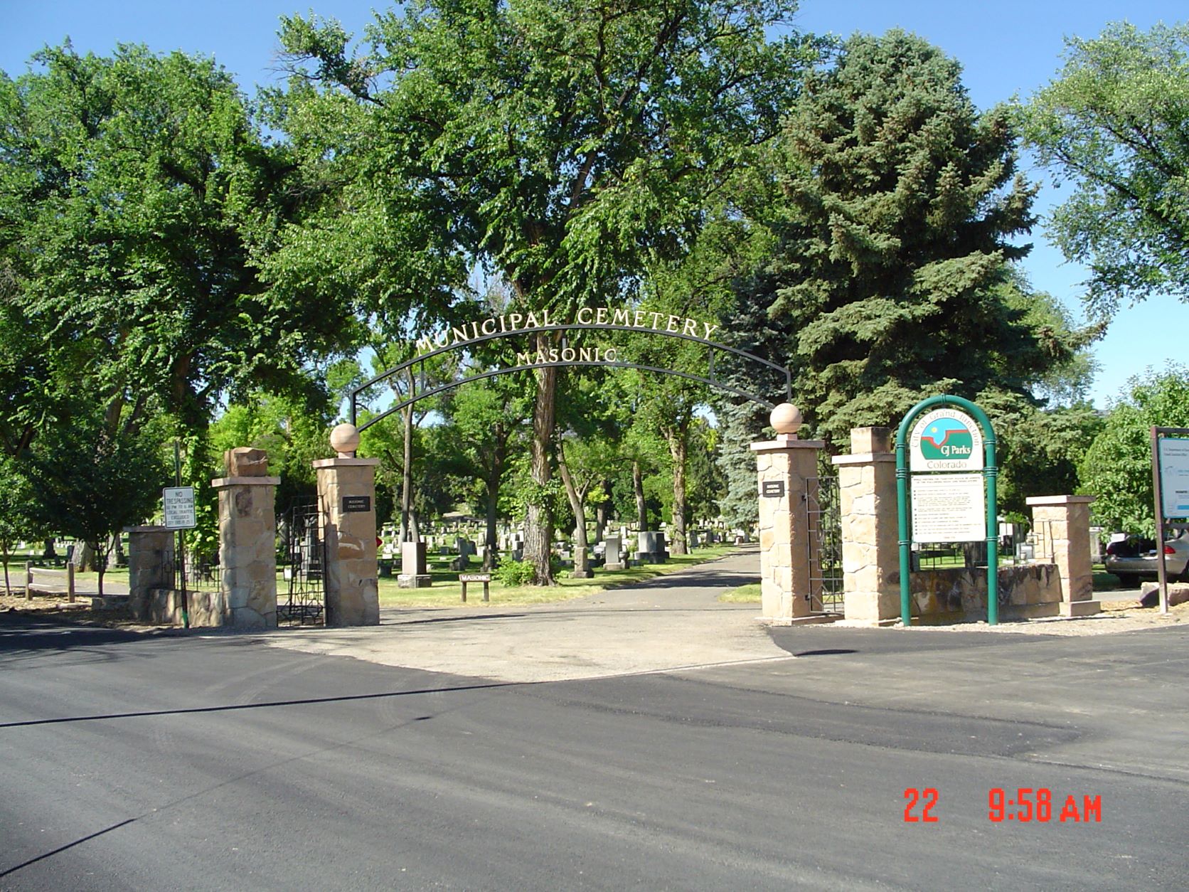
Masonic Cemetery- **Photo Credit: DRJ 2004
Find a Grave - Masonic Cemetery.
Gate Location Address: 269 26 1/4 Rd
Directions: From Highway 50 turn South on Canon Street (26 1/4 Rd) about 0.14 miles to intersection of Canon St. and B 3/4 Rd. The cemetery is on the right on the SW corner of the intersection,
There is a note in the 'Hope Cemetery' folder located in the library in the Museum of the West that mentions that some of burials were moved to the South part of the Masonic Cemetery when the Hope Cemetery was abandoned. This could be something the MCGS Cemetery Project Committee could look into.
Back to Cemetery Alphabetical List
Memorial Gardens (Grand Junction)
1953 (?) - Present
The cemetery website lists 1953 as the date established, however there are burials listed on Find-A-Grave prior to this date.

Memorial Garden Cemetery - **Photo Credit: DRJ 2004
Find a Grave - Memorial Gardens.
Gate Location Address 2970 North Ave.
Directions: From Grand Junction PO go East to 5th St., then go North about 0.6 miles to North Ave. Turn Right (East) and go about 3.5 miles (past 29 1/2 Rd) to 2970 North Ave. The cemetery is on the North side of North Ave.
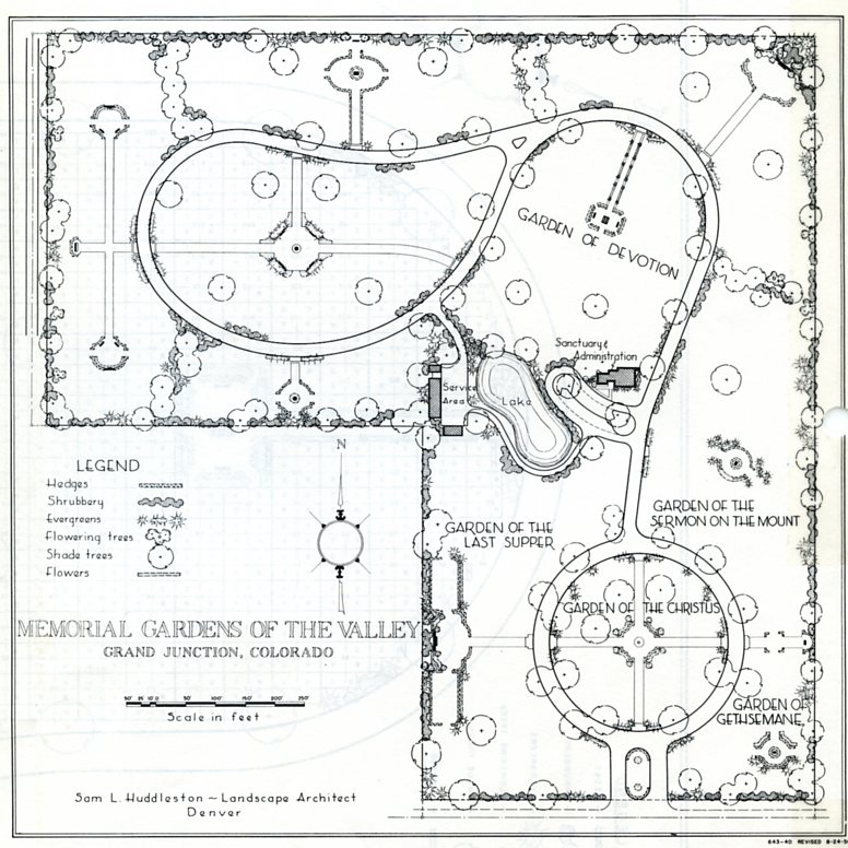
Initial Memorial Garden Landscape Plan 1956
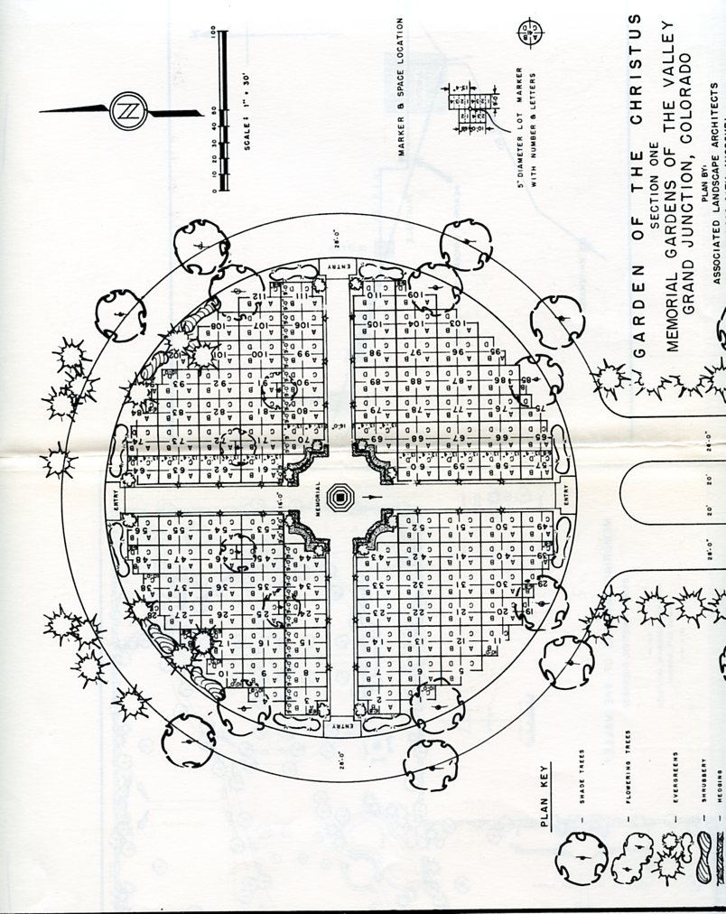
Garden of the Christus Section 1953
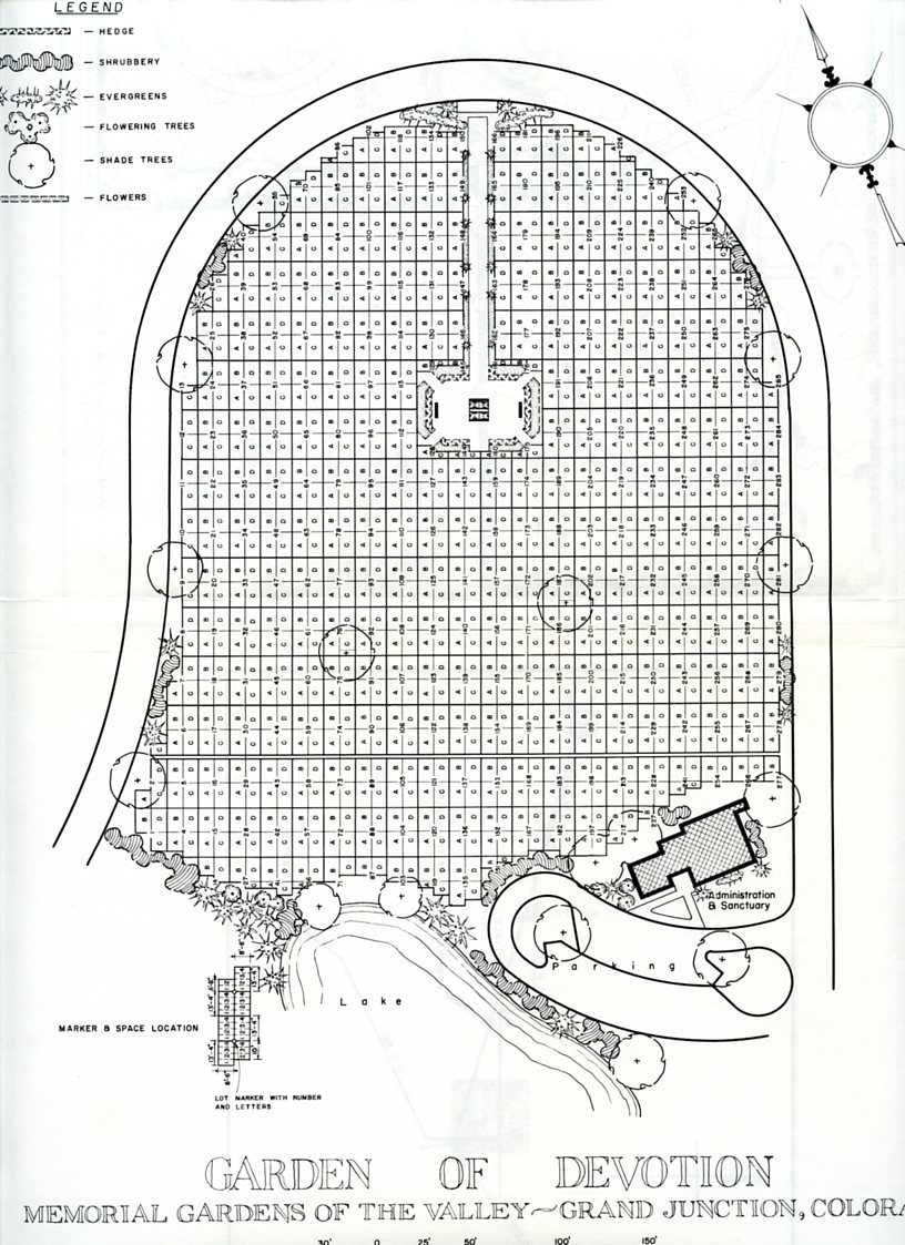
Garden of Devotion Section 1956
Back to Cemetery Alphabetical List
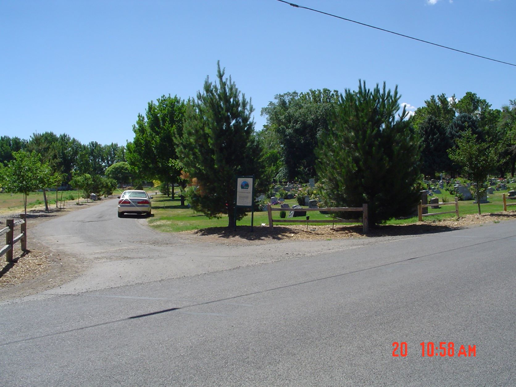
Municipal (Grand Junction) Includes: Cremation Gardens and Memorial Forest
????
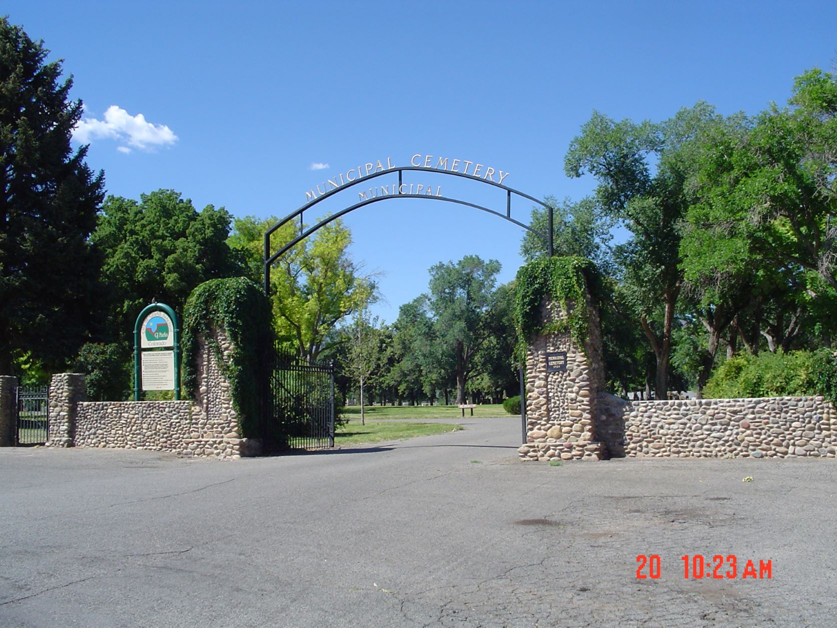
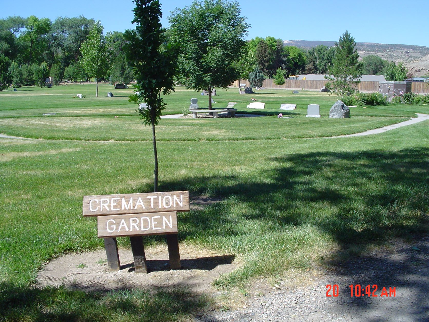
Municipal Cemetery and Cremation Gardens - **Photo Credit: DRJ 2004
Find a Grave - Municipal Cemetery.
Gate Location Address: 291 26 1/4 Rd
Directions: Take Highway 50 South to Canon St (26 1/4 Rd). Turn South and go a short distance. The Entrance to the cemetery is on the right side (North) of the road.
Back to Cemetery Alphabetical List
Palisade Municipal
????
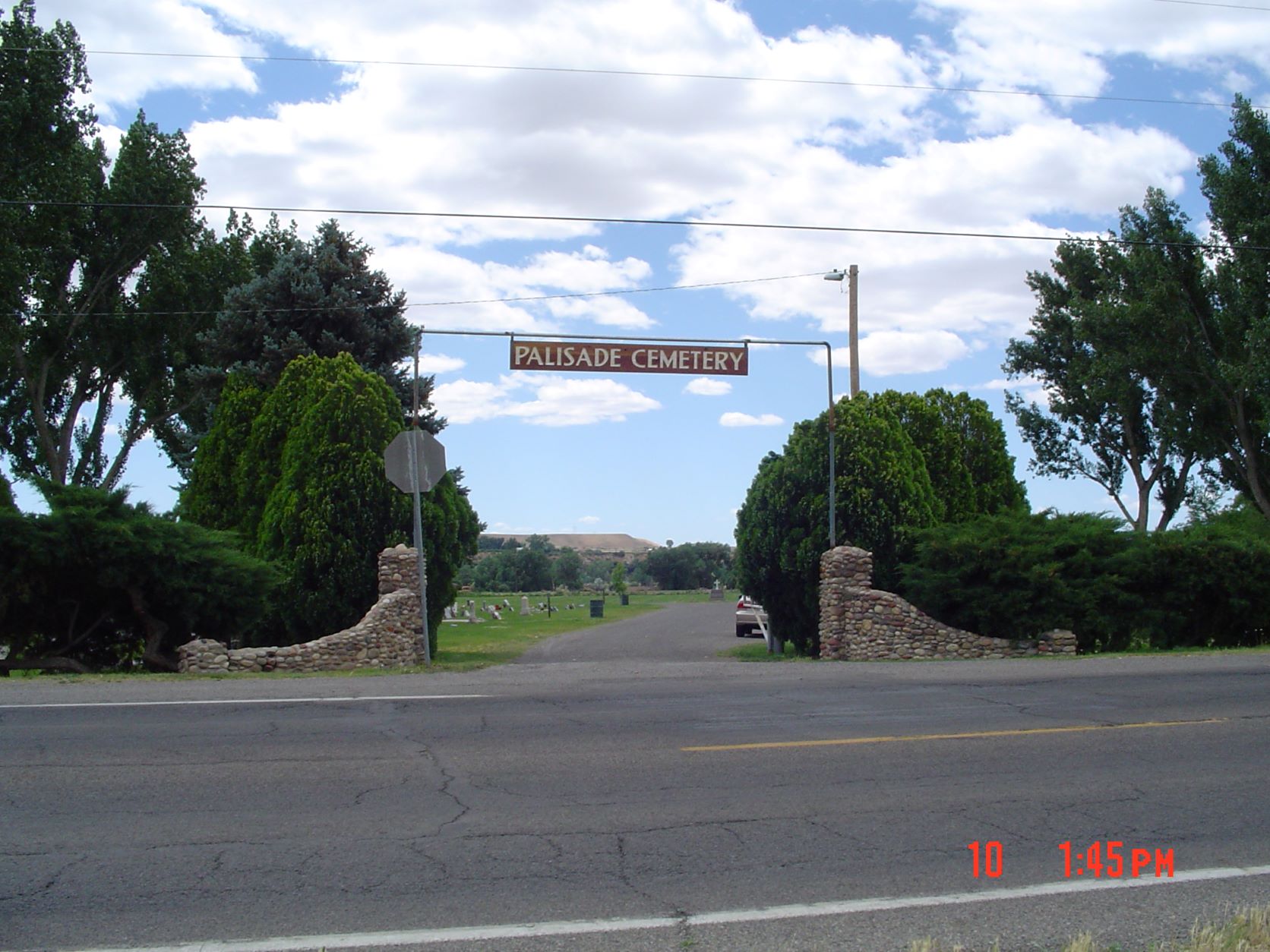
Palisade Cemetery- **Photo Credit: DRJ 2004
Find a Grave - Palisade Cemetery.
Gate Location Address: About 3529 Highway 6
Directions: From Palisade P.O. go South 0.3 miles to US Highway 6 and turn right (West). Go about 2.5 miles to the cemetery which is on the South side of the road.
Back to Cemetery Alphabetical List
Veterans' Cemetery (Grand Junction)
????
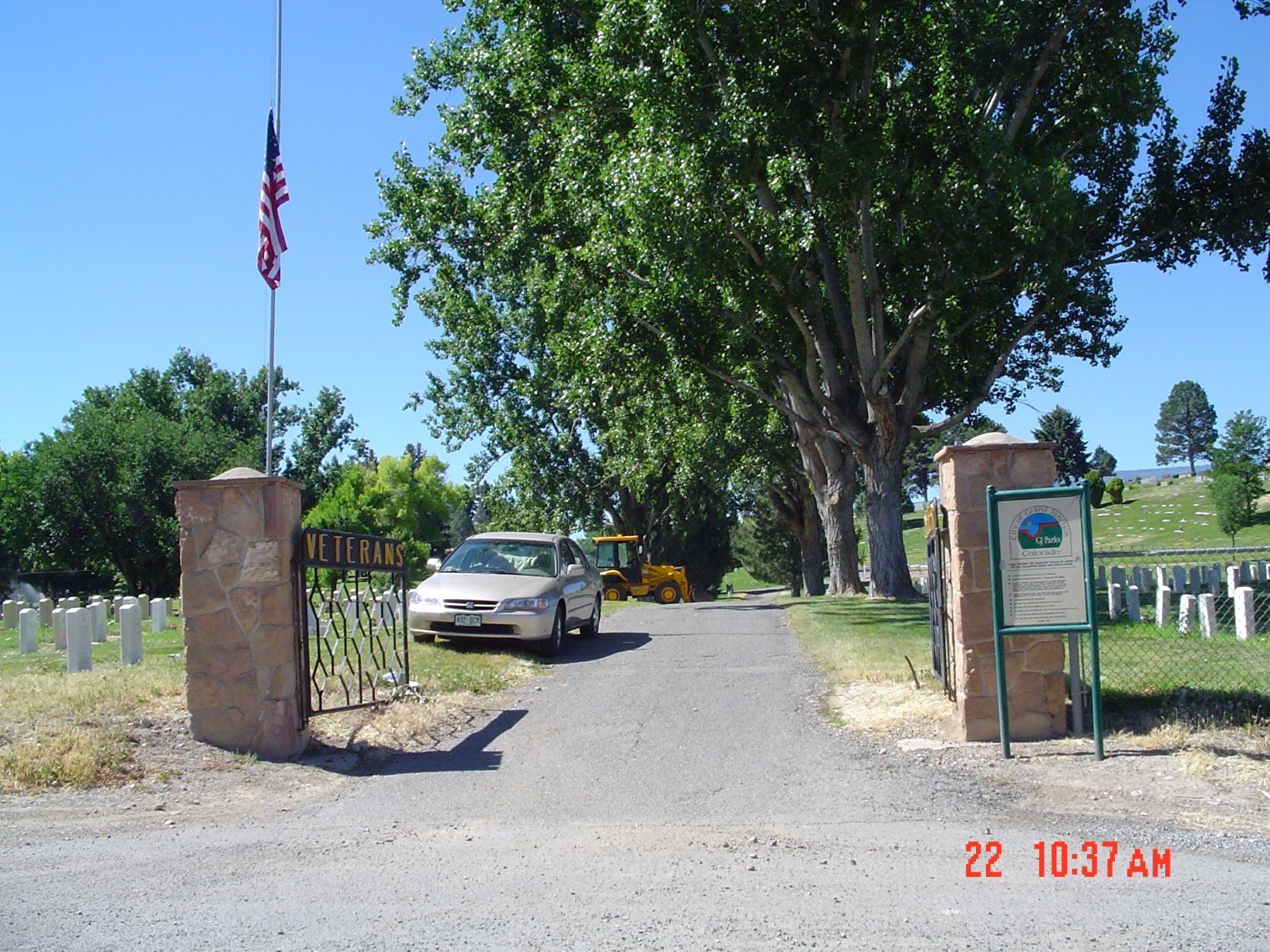
Veterans Cemetery- **Photo Credit: DRJ 2004
Find a Grave - Veterans Cemetery
Gate Location Address: B 3/4 Rd
Directions: From Highway 50 South of Grand Junction P.O. turn South on Canon Road (26 1/4 Rd). Go West past IOOF Cemetery about 0.2 mile. Cemetery is on the left (South) side of road.
Back to Cemetery Alphabetical List
Veterans' Memorial Cemetery of Western Colorado (Federal)
????
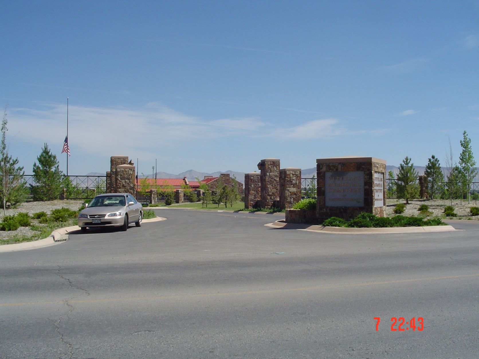
Veterans Cemetery- **Photo Credit: DRJ 2004
Gate Location: 2830 D Road.
Directions: From Grand Junction Post Office go South to Atkin Ave, East to 9th St, South to D Road, then East on D Road about 1.8 miles to Cemetery. Cemetery is located on left (North) side of the road.
Back to Cemetery Alphabetical List
Mesa County Genealogical Society is a member of the Colorado Council of Genealogical Societies (CCGS) and the National Genealogical Society (NGS). The Federation of Genealogical Societies (FGS) was merged with the NGS in the summer of 2019.
